Ottakovil Fm
Type Locality and Naming
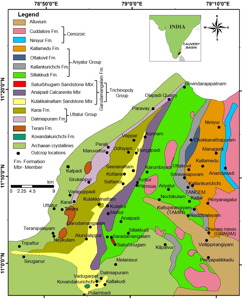
ARIYALUR-TRICHIRAPPALLI OUTCROP: Named after Ottakovil village, Ariyalur district, TamilNadu. Type locality = 7 km North of Ariyalur town. Outskirts of Ottakovil Stream section, Ottakovil village.
[Figure 1: Geologic map of Ariyalur area]
Lithology and Thickness
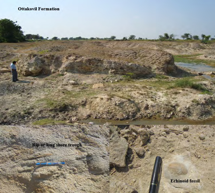
Sandstone. Grey, dirty yellow to off-white, cross bedded, medium to coarse, micaceous friable sand and well cemented, fine-to medium grained sandstone (Tewari et al., 1996) and thickness is computed to 60 m (Sundaram et al., 2001).
[Figure 1: Field photos of Ottakovil Formation. Outcrop, Rip or long-shore trough, Echinoid fossil (provided by A. Nallapa Reddy and R. Nagendra)]
Relationships and Distribution
Lower contact
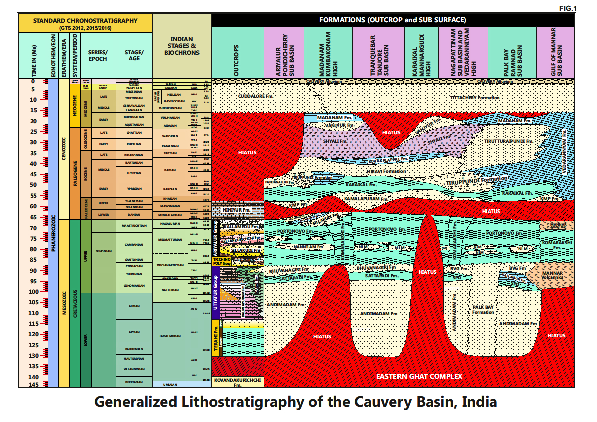
Conformable onto upper surface of Kallankurichchi Fm
Upper contact
Unconformable with fluvial Kallamedu Fm
Regional extent
Lithological exposures along the stream section from Ottakovil to Anandavadi in an eastern direction
GeoJSON
Fossils
In the upstream section, the sandstones are associated with echinoids, Trace fossils-Thalassinoides, Ophiomorpha. In the downstream section are echinoids, Nautilus, ammonite, Alectronia/Lopha (Tewari et al, 1996) and calcareous nannoplankton (Jyotsana Rai and Ramkumar, 2007) .
Nannoplankton zone equivalent to Gansserina gansseri planktonic foraminifer zone is recorded from Ottakovil top.
Age
Depositional setting
A relatively low energy, open marine, lower-upper shore face environment. The trace fossils indicate a marginal marine, reduced sedimentation environment of deposition. The associated ammonites are suggestive of more open marine conditions in an otherwise shallowing basin.
Additional Information


